
Finding People Along a Roy Street
A useful street directory starts with one exact address and builds a record trail outward. The first result should be a parcel number, not a guess about who lives there. From that identifier, the county map, recorded instruments, public voter fields, and older address directories can be compared without collapsing ownership into occupancy.
Walk the search in this order:
- Run the address in Weber County Parcel Search and save the parcel number, legal description, property address, and mailing address.
- Open Weber Geo-Gizmo, find the parcel, and note adjacent parcel IDs and map context.
- Use the Recorder/Surveyor reference to follow the current recording link, prior parcels, plat, or abstract route.
- Compare public voter data only when the question and access route fit Utah’s rules, remembering that protected voters are withheld.
- Use the regional Ogden/Weber street section in a historical directory for older households, then confirm a name with another source.
This sequence keeps a Roy street directory grounded in address evidence. It also leaves room for a missing parcel, a changed street label, or a mailing address in another postal city.
Roy Street Directory Fields
The county service description confirms three starting modes: parcel, owner, and address. Exact live labels are not fully exposed in the inspected legacy form, so use the displayed form controls at search time. If an address fails, try directional words, street abbreviations, an older locality label, a nearby intersection, or an owner search.
| Parcel | Use the county identifier when a deed, tax card, or prior record supplies it. |
|---|---|
| Owner | Search a titled owner name, then compare the returned property and mailing fields. |
| Address | Enter the property address; preserve the exact spelling and number the county returns. |
| Follow-up | Open the official ownership page for tax area, recording reference, prior parcels, plats, and legal description. |
The Weber Assessor FAQ is useful when a parcel number or property characteristic is unclear. It is better to ask the county about a failed match than to infer that no record exists.
Roy Street Records in One Chain
Several address-keyed record sets can be placed beside one another. The parcel roll owns the current property description. Geo-Gizmo supplies a visual map. The Recorder supplies deeds, plats, and title-abstract routes. Roy planning material adds project and unit-address evidence, while directories provide an older address-to-name layer.
| Record set | Custodian | Street-level clue | Access |
|---|---|---|---|
| Parcel and assessment | Weber Assessor / Recorder | Owner, parcel, situs and mailing address | Free search |
| Geo-Gizmo | Weber GIS / Surveyor | Parcel polygons, map layers, adjacent lots | Free viewer |
| Deeds and plats | Weber Recorder / Surveyor | Grantor, grantee, dates, lots, prior parcels | Index, counter, abstracts |
| Voter data | Utah elections / Weber Elections | Defined registration address fields | Request or lookup, limits apply |
| Planning records | Roy Community Development | Unit addresses, permits, zoning and project dates | Packets or records request |
| City directories | Marriott / FamilySearch / library | Historical street-to-household clues | Digital, microfilm, reference desk |
The parcel number is the main bridge. It carries a current street search into a deed or plat, while a street name carries it into an old geographic directory page. For the full collection story, use the Roy directory book.
Roy Street Geo-Gizmo Walk
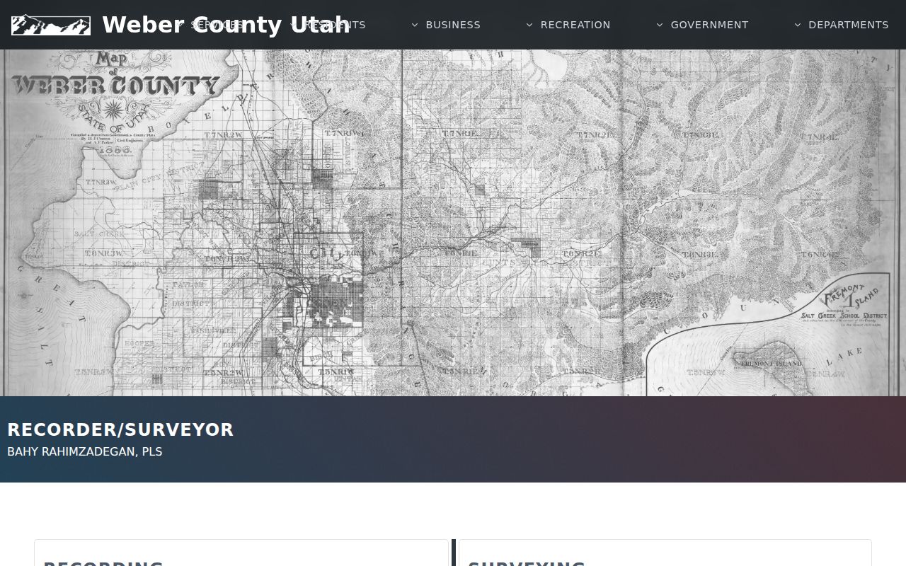
Weber’s official Surveyor material describes Geo-Gizmo as a map and parcel tool. Search “Find address or place,” zoom to parcel scale, click the polygon, read the popup, and follow “More Parcel Info” where offered. To browse a Roy street, pan from the known lot and click the immediately adjoining polygons one at a time. Record parcel IDs before grouping owner names.
The viewer is valuable for orientation, but its tax-map lines are visual representations rather than exact surveyed boundaries. A measurement tool can show distance on the map; it cannot establish a legal boundary. Use a recorded plat or survey when the line matters.
The Weber Surveyor interactive guide explains the map, parcel, and disclaimer context behind a street search.
Roy Street Address Fields
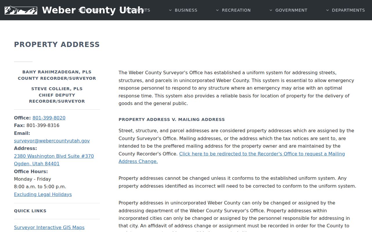
Weber’s property-address and mailing-address databases solve different problems. The property address locates the parcel or structure. The mailing address receives tax notices and can point to Riverdale, Ogden, or another place even when the situs is Roy. A tax-sale list can likewise show an owner’s mailing address rather than the property being discussed.
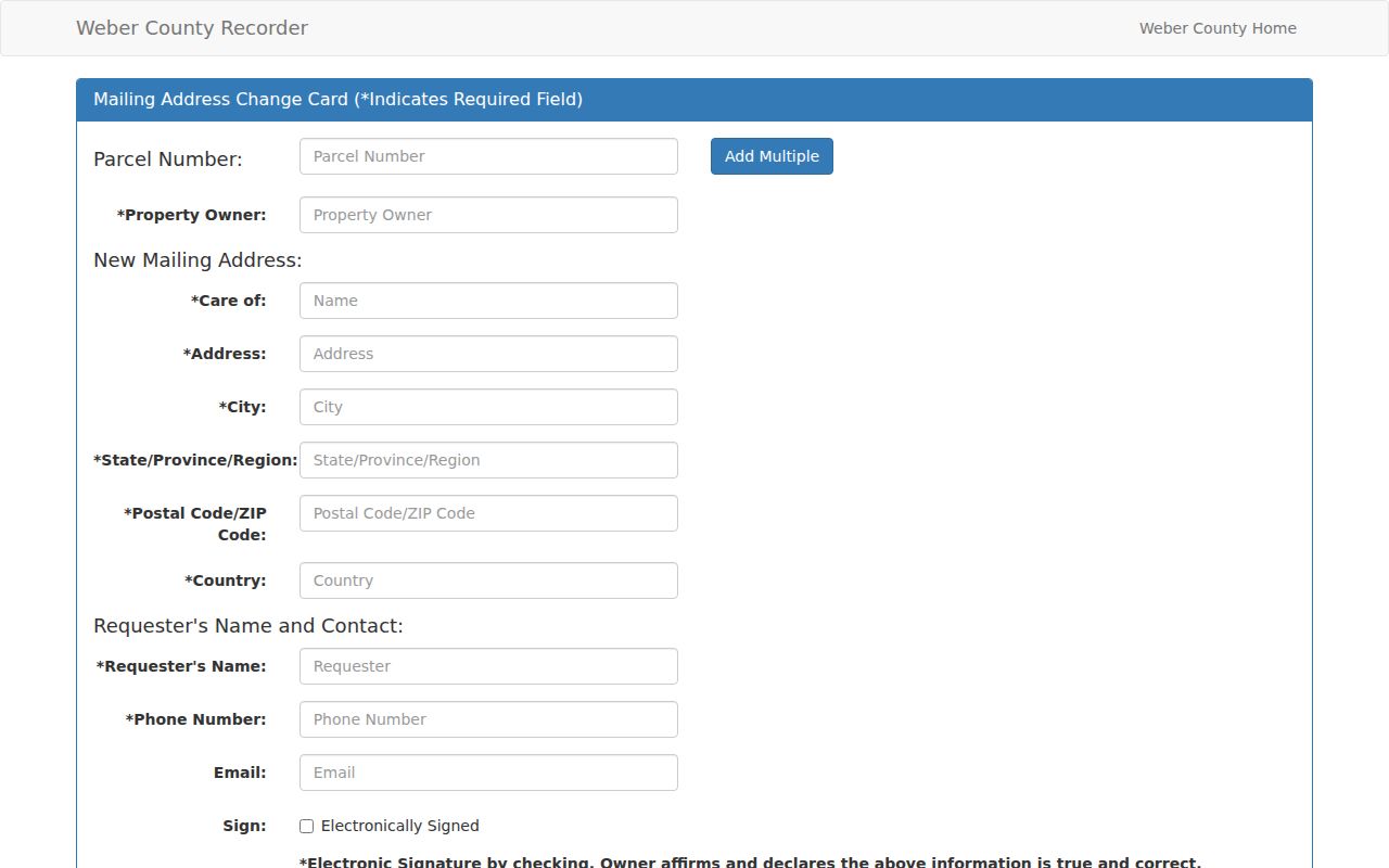
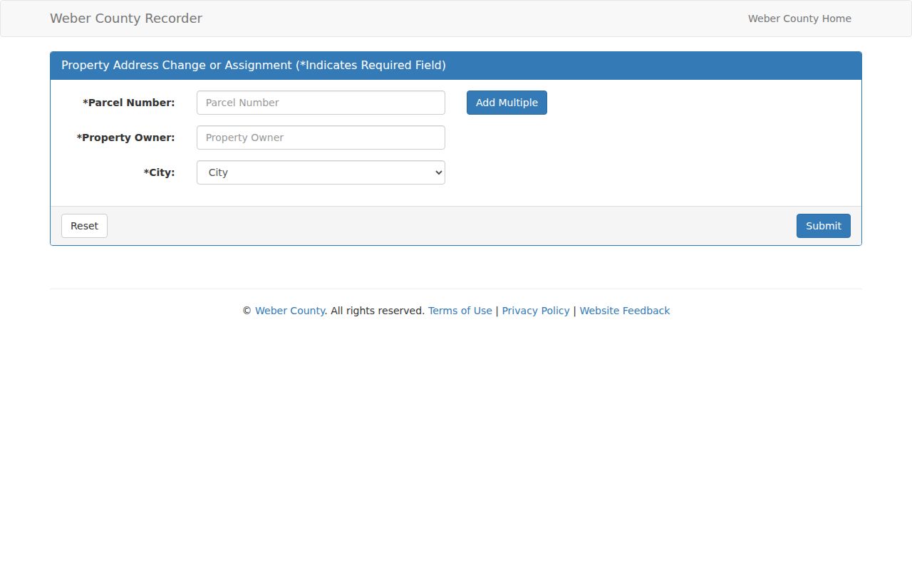
The county mailing form calls for a signed written owner request and says the change is not made by phone. The property-address assignment or change form asks for parcel, owner, city, requestor, change type, phone, email, description, authorization, and electronic signature. An incorporated-city change needs city approval or an affidavit. See the mailing-address form and property-address form before treating a mismatch as a data error.
The county property-address page gives the distinction that matters most in a Roy street directory.
Use the Weber mailing-address change form when the tax-notice destination needs a documented update.
Use the property-address change form for a parcel or structure address question.
Read the Roy Street Parcel Card
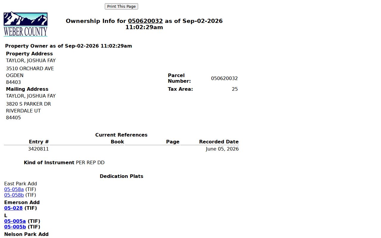
An official ownership result can display owner, property address, mailing address, parcel number, tax area, current recording reference, plats, prior parcels, and a legal description. Those fields are stronger together than a name alone. Keep the exact punctuation in a lot-and-block description or in a metes-and-bounds description because it may be the only bridge to an older parcel.
- Parcel
- The county identifier that joins the map, assessment, deed, and plat trail.
- Situs address
- The physical property or structure address used to locate the lot.
- Plat
- A recorded map that may show lots, blocks, subdivision names, and predecessor parcels.
- Criss-cross directory
- A street- or address-ordered historical directory section used when the person’s name is unknown.
Open the official sample parcel card to see the fields a street search can carry forward.
Deed Chains Along Roy Streets
Start with the current recording reference on the parcel page. In the Recorder’s trail, identify the grantor and grantee, date, instrument, legal description, and any prior parcel or plat reference. Open the earlier instrument, then repeat. For a whole street, do this for each parcel and group shared subdivision or plat names to see how a development phase formed.
The Recorder/Surveyor page offers free parcel links, a paid Title Abstract Search, recorded-document routes, plats, historic tax maps, and a separate Old Abstracts link labeled Pre 1980. The public page does not state a complete historic cutoff, so do not invent one. Use the Weber Recorder / Surveyor page for the current options.
Roy Street Permits Date Buildings
Roy planning packets show why permits can help date a street without naming every household. A 2024 planning review includes building addresses for units, building permits before construction, land-disturbance and stormwater conditions, site-plan review, subdivision phases, and zoning conditions. Ask Community Development for records by address, parcel, and date when a project history is needed.
A permit can establish that a building or phase was reviewed. It cannot establish who occupies a unit now. The public research did not locate a searchable Roy permit database, so use a planning packet, city contact, or specific GRAMA request. This is a useful gap to state plainly in any street history.
Roy Street Directory History
The historic address layer is not a verified Roy-only criss-cross series. Marriott’s digital collection describes Ogden and Weber volumes arranged alphabetically and geographically. The geographic section is the reverse-directory-like part: search a street, then move to the alphabetical residential entry to confirm a name, occupation, or address. FamilySearch catalogs the 1883 Ogden and Weber directory and Ogden microfilm from 1890–1901.
Later regional Polk runs include selected 1940s–1960s volumes and 1973–1982/83 volumes with Roy. Search Ogden, Weber County, suburban towns, and old locality names as well as Roy. A street entry can support family history or address history, but it remains a historical clue, not a present occupancy statement.
Roy Street Labels and 84067
The official Utah ZIP list identifies Roy with 84067. ZIP geography is mail geography, not a city-limit polygon. Nearby Ogden, Hooper, Huntsville, and Eden postal places matter when an address sits near a local or postal edge. Verify one mailing address with USPS ZIP lookup, and verify municipal jurisdiction with Geo-Gizmo or the parcel record.
Vacant Weber parcels typically do not receive a normal property address until a building permit is issued. Older legal descriptions may use lot, block, and plat language or detailed bearings and distances. If a modern street search fails, search the predecessor parcel, plat name, or earlier locality label rather than assuming the land had no history.
What a Roy Street Directory Leaves Out
A street directory built from public records does not show every person at an address. Household members, guests, utility customers, delivery recipients, and DMV address records are outside the public parcel trail. Voter data has private fields and protected categories. Safe at Home hides actual addresses, and sealed or restricted court and vital records remain closed.
Lawful use. Roy street and address records support personal, family-history, civic, and safety research. Do not use an address result to stalk, harass, intimidate, or harm anyone.
When the goal changes from a whole street to one person, use the Roy resident lookup workflow. When a current address must be traced backward, use the previous-residents search and preserve the parcel trail.